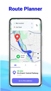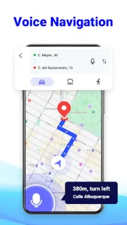
A missed turn can turn a school pickup into a scramble, especially when traffic bunches at a junction you don’t know. I’d use this app to map the drive before setting off, then keep step-by-step voice directions on so I can focus on the road. The useful bit is having a route planned for a patch where mobile signal may be unreliable; it’s less helpful if I wait until I’m already lost to work out where to go.
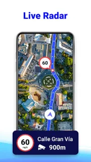
GPS Route Planner: Radar Map combines route planning, voice navigation, a speedometer and a radar map intended to alert drivers to speed cameras. Its description also offers offline maps, satellite map viewing, Street View and local travel recommendations. That gives it several jobs on a trip: check the destination before leaving, follow spoken directions on the way, and look for places nearby. The listing describes routes based on live traffic, so traffic-aware planning depends on having a usable connection when you’re choosing the route.
The first thing I’d check is the route before driving: offline maps can help when a signal drops, but I wouldn’t assume every live feature works without connectivity. The app contains ads, which may be a distraction when you’re trying to set a destination or review directions, so make those choices while parked. Location access is central to navigation and sharing a real-time location; grant it only if those features suit your plans. Treat camera alerts as a prompt to pay attention, not a guarantee that every camera or speed limit will be covered.
I’d consider installing it if I want one place for voice directions, route planning and a map to prepare before a drive, including unfamiliar airport roads or a hotel check-in. It may not suit someone who wants an ad-free screen or expects offline maps to replace a connected navigation service everywhere. For flights, this is a road-navigation companion, not a travel booking tool. If that trade-off fits, use the Google Play button just below to open the listing and check the app details before installing.